Thursday, June 25, 2015

Epic Owl's Head Aventure Trek!

Follow the Tail!
Hi!!!

I did Owl’s Head with my Moriah and my Laura. Owl’s Head has the longest trail to summit of the NH 4,000 footers. The good thing is that 8 miles is almost flat. The bad thing is that the one mile is up-up-up! We did this big-mountain trip on the almost summer solstice day so we could have plenty of daylight. Some people will camp overnight but we knew Team Locomo could get it done!

You start at Lincoln Woods and take the Lincoln Woods trail for 2.9 miles. It is really very flat but you have to watch out for the old wood railroad ties. Don’t trip! You still have a long way to go. The next trail is Franconia Brook Trail and you get to cross the brook a few times. After that is Lincoln Brook Trail and guess what? You get to cross the brook a few times! I lost count of how many water crossings we did but two of them on the Lincoln Brook trail were hard! Laura and Moriah brought water shoes for those because there aren’t enough rocks to jump across. We looked around for good places to cross but in the end I just had to go in the deep sections and even SWIM part of it!!! (Laura Note: Frisco doesn’t like swimming.) Those two river crossings are close together or easy trails so you humans can keep your water shoes on in between them. All the other water crossings were much much easier.


STEEPNESS!
Eventually, you will get to a trail that goes up the infamous Owl’s Head slide. You don’t actually see the slide at the start of the trail. Just keep an eye out because sometimes the cairn gets taken down. The slide is the tough part for humans and dogs. It is super steep and there are really loose rocks everywhere. Also, the slide is not just loose rocks. Sometimes it is wet rocks. Sometimes it is loose dirt. Sometimes it is mud! We saw a guy coming down with a tiny puffball dog who was scared of me and yapped. She got to be picked up and carried down. My Laura said no to carrying me.
Victory!

Luckily, the slide is only a mile long. When you get to the top there is a clearing that was called the summit but it is not REALLY the summit. The 4,000 footer club accepts it though because there isn’t a real trail to the true summit. There are trails, but they are all over the place! We easily found the big-cairn summit marker but we almost got lost trying to find the right trail back to the slide. We saw other people going towards the summit which helped us find the way.

Lunch break on the slide with the only view
There were bugs every time we stopped so we had our lunch break on rocks halfway down the slide. It was good to have a break down the slide because that’s the only place with good views and going DOWN the slide was worse than up! The 16 miles of flat trails during the day was ok but the one mile up and one mile down was what got us tired.

When we got down the slide, we only had 8 miles left to go! It seemed like a lot but really wasn’t too bad. I felt like the water crossings were easier on the way back. (Laura Note: I think watching Toby the Corgi cross the rivers helped Frisco be brave.) We also got the LOCOMO-tive going on the smooth parts and ran. Love the running! Just don’t trip on the railway ties! At the very end we caught up with some nice guys we saw at the beginning of the day. They said hi to
post-hike selfie!
me every time we crossed paths. We even saw a deer walking across our trail when we were almost back to the car! We got back in time for the clouds to look stormy. It was a long trip but pretty fun and post-hike chikkin nuggets made it worth it.
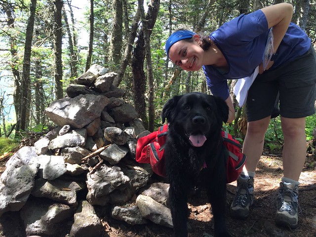
Something helpful about water levels:
http://waterdata.usgs.gov/nh/nwis/uv?site_no=01074520

Bye!

~Frisco

Owl’s Head
Elevation: 4,025 ft
Trails: Lincoln Woods Trail, Franconia Brook Trail, Lincoln Brook Trail, Owl’s Head Path, unofficial “trail” to summit
Distance: 18.5 miles


Owl's Head

Monday, June 22, 2015

Follow me on Instagram!


Now you get more of me! Or at least more photos of me. Or at least photos of me.


Instagram Click the buttony thing!

Tuesday, June 16, 2015

Mount Percival & Mount Morgan Loop

On top of Mount Percival - Squam lake in background
Hi!!! 

 Oh dear. I haven’t blogged very much lately. I had winter adventures but just never settled down and told about them. That’s okay though. My Laura knows magic so I can write them later and make it look like they were written before this. Shhhh...

My first hike this year was just some little mountains but it was good to do a warm up hike. Even though these are half the size of my 4,000 footers, they are twice as big as my Hall Mountain near home (941 ft).
It was a nice day and not too far to drive. The best part is I didn't have wear my backpack! My Laura forgot! (Laura note: I didn't forget... oh never mind.)

Mt Morgan and Mt Percival have a few choices. Our first choice was to start at the Mt Morgan Trailhead to have less time to walk down to the car. The second choice was to go up Mount Percival by using the Morse Trail connector. This trail was short and fast and super easy. The Mount Percival Trail really wasn’t hard at all for the most part until you get near the top... dun dun duhhhhnnn!
Decisions going up Mount Percival Trail

This actually happens on both Mt Morgan and Mt Percival. On the Mt Percival side, you get
Percival's Cave
caves to the left and cliffs to the right. Zac really really wanted to do the caves so we tried that first. Well, I made him try first. He got IN the cave, but he couldn’t get OUT the other side. I waited impatiently whilst my Laura had to go look too before they both squeezed back out and we took the cliff side trail.

The cliffs weren’t really scary cliffs at all. I did need one boost on a long jump but it wasn’t harder than my big-mountains. The top has very nice views of Squam Lake.

After snacks we continued on to Mt Morgan. The trees get in the way so there isn’t as much to see. There is a summit sign and survey marker from the Boston Museum of Science. Boston. New Hampshire. Boston. Maybe I need to learn geography because I am confused.
We were here. Mount Morgan.

When you come off Mt Morgan you get the two trails again. We guessed which one to take and guess what? We chose wisely! They meet up again but we went with the one with the sign pointing back to the road. It wasn’t clear that the other trail was the one with caves... AND ladders! Ladders are hard and going DOWN ladders is not fun at all!!! We found the beginning of the ladders and caves and Zac had to peek in again. He says he could have fit through but it wasn’t fun to go down the ladder. I wouldn’t have gone up it either!

The rest of the way down Mt Morgan trail was easy. It was smoother than Mt Percival Trail
LADDERS!
so it was good to be doing the descent that way. Unless you want to go up the ladder (crazy humans), I liked the counter-clockwise loop. If you choose the right trails, this is nice for dogs and kids too!


Bye!

~Frisco

Mt Percival & Mt Morgan
Elevation: 2,212 ft, 2,220 ft
Trails: Mt Morgan Trail, Morse Trail, Mt Percival Trail, Craford-Ridgepole Trail
Distance: 5.4 miles